Letter A marks Kalama
|
Kalama Main Street 1
|
The Kalama I thought I knew:
Interstate 5 races from Mexico to Canada behind the concrete wall and beyond that the Columbia River divides Oregon and Washington. The place to stop for a popsicle when enduring the slog between Seattle and Portland. Lovely by train. But then you wouldn't get to see Kalama.
Something was different, though. Why do the new pavers end at the bench, halfway down the block? The mark of a makeover.
Still lots of free parking on First Street, I noticed.
Kalama Main Street 2
|
Definitely something different. K had been spruced up.
Kalama Main Street 3
|
Kalama Main Street Detail
|
K had color, and it appeared to be welcoming me. To a point.
After all, in a lifetime of living in the northwest, I had stopped relatively infrequently in Kalama. It is conveniently located on our frequent road trips between Seattle and Portland or Eugene. But its near neighbor on the banks of the Columbia was the Trojan Nuclear Plant (be careful if you google this--but worth it for the video of its massive implosion). A gigantic concrete hulk, it was the set for "China Syndrome." Or so it was rumored until IMDB listed a nuclear plant in El Segundo as the actual location. But you couldn't look at this structure, a landmark seen from miles away on any freeway trip in my younger days, and not reflect on the potential destruction of the planet. And now I'm kind of sad it's gone--not the nuclear energy, but the building.
Trojan Nuclear Power Plant
|
In nearby Yelm, the mothballed-satstop-nuclear-plant is being rented out to movie makers. At least they had a little foresight.
Satsop Nuclear Power Plant near Yelm
|
So I usually resisted the temptation of a popsicle or a gas station restroom. Seeing that tower was enough to frighten me off.
But now Kalama is shiny and new, and there is no more nuclear tower.
On a historical note, Lewis and Clark were wet and miserable, as usual, here in 1806. They found the valley "crouded with Indians".
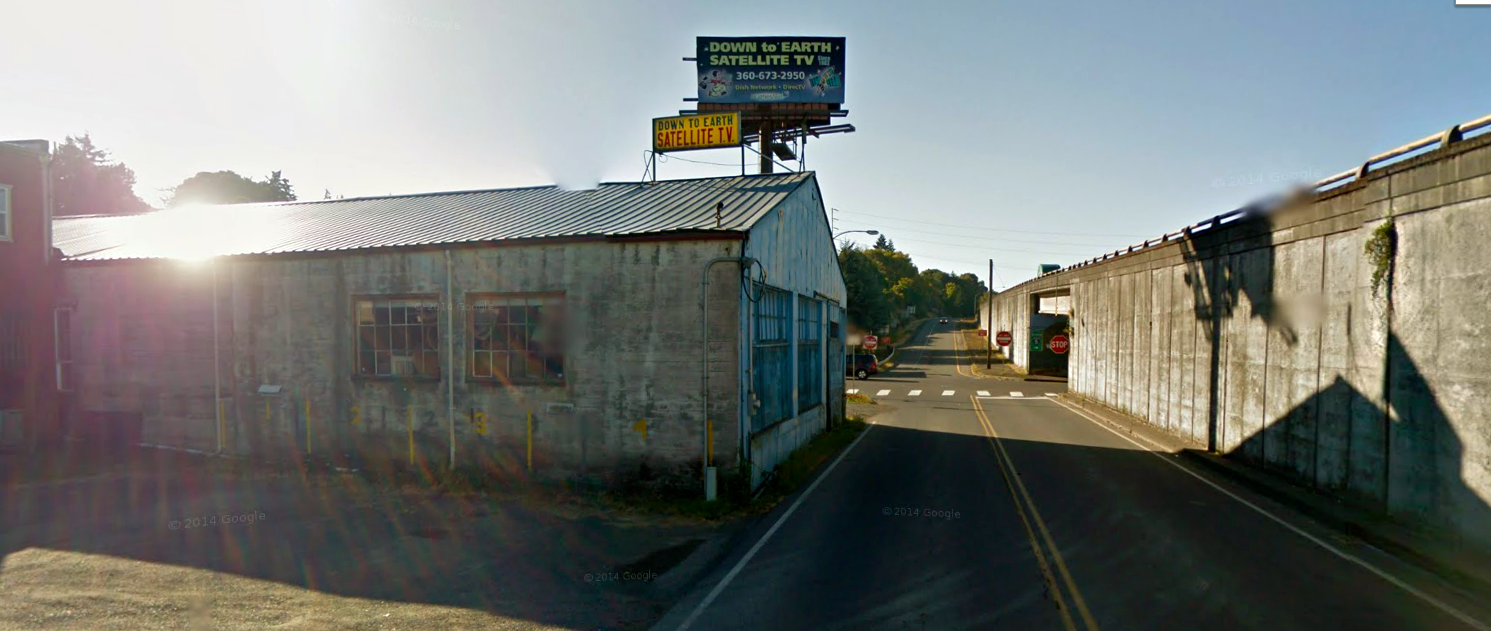
Google Street View, however, revealed Kalama on an early morning even sunnier than ours, and they found the I-5 underpass in the process of being painted by an energetic group of community activists:
I remembered being quite taken with this mural, but also thought the matching planters gilded the lily a bit. It is under the freeway, after all.
And on the other side of the underpass, leading ever closer to the river banks of the Columbia, were these gallant soldier puffballs. From about a hundred previous posts, we know that puffballs are the wily tricksters of the plant world. These rascally deceivers were trying to hide something.
Busted! Guarding the City's sewage treatment plant.
We retraced our steps. Later in Google Street View, I found the monkey puzzle tree I had seen from the freeway outside the town's gas station. It appeared rather ghostly, its shadow exaggeratedly spindly and elongated.. like the puffballs it appeared ominous. Not nearly as ominous as the nuclear tower, but still...I almost felt I was being warned.
Fir St and First
|
Back home, I wondered, where does Google Street View land you if you enter "Kalama?" Where is it's "port of entry?"
I soon found out: at the intersection of Fir St and First (love that!), and just as in real life, Google Street View revealed that K's Main Street is full of the amenities of modern urban design:
Freshly painted crosswalks. Check.
Distinctive pavers. Check.
Curb cuts with adaptations for sight/impaired pedestrians. Check.
Landscaping on all four corners. Check.
American flags on three corners. Check.
Bench and matching garbage containers. Check.
Tasteful street lighting. Check.
Historic plaque on bank. Check.
Street trees of appropriate scale. Check.
Even half a block from First Street, where all the urban design boxes are ticked, the parking lot next to the antiques mall has been given a make-over. Sturdy bench, bark and shrubs. Is it just me or has the parking lot gravel been groomed?
Playfield complete with another American flag is directly across the street on the right.
But the same building from behind reveals the Kalama I know and love.
We were on a mission to find the riverfront, so we quickly found our way back to the two-lane hole in the wall under the underpass, above, on the right.
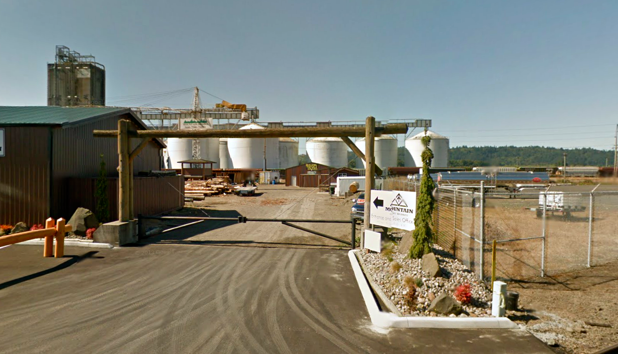
And this time we found on the banks of the river: Logs. Lots and lots of logs. Many many more than I remember seeing in a very long time.
And in places, the Google Street View revealed the Kalama riverside that I once knew, behind the new facades of industry.
Peek-a-boo views of the river, more logs, and an actual house for sale with a forest of ominous storage tanks behind and a hasty makeover in front.
When was the last time I saw a floating log boom?
And now I remembered. Kalama is a port. I'm sure there used to be a sign saying that. In fact, that's all I ever knew about Kalama. A freshwater port on the Columbia River.
Home to some of the largest grain elevators in the world. Sending out corn, soy and wheat carried by train and truck. The Chicago of the Columbia River.
Aha. So two separate Kalamas have evolved side by side. One is the old Kalama with the nuclear tower and the grain elevators.
Again I'm struck by how difficult it is to actually access the waterfront from the town. Later I learned it is home to the tallest totem pole in the world (140 feet). There are four of them in all, and they are supposed to reside at the Marine Park, which we never found.
So I never did see the totem poles, which was a disappointment to me because I'm a huge fan of Chief Lelooska, who did them for the 1962 Seattle World's Fair.
Here is the sign denoting a Recreation Area south of the logboom. It turns out to be a snappy new marina. Interestingly, the sign doesn't face the town. Is anything ever easy in Kalama?
The other, newer Kalama, is a meta-version of the old Kalama. A recreated home town, complete with dusted off totem pole, a new marina and park, to lure all the businesspeople and developers to locate here. Because business is booming in Kalama. Now, an $88,000.00 Homeland Security grant (earmarked for video cameras) also serves to entice visitors, future residents and businesses to the town. The riches of homeland security frequently rain down on waterfront towns in the form of urban design amenities. You see it all the time.
A week after I got home I discovered that Kalama is an international port to large bulk carrier ships, all of which carry soy, wheat and corn to Asia and Mexico. The ships go out to China, Bangladesh, Mexico...but more importantly, they have their maiden voyages in Kalama. This is a big deal. These ships have come from all over the world. Why do they have their maiden voyages in Kalama?
These ships go out of their way to start their maiden voyages in Kalama because it actually saves time and money. Traditionally, carrier ships like the Storm Rider, Coral Crystal, Q Keen and Figalia are required by the Coast Guard to treat their ballast in open sea water to remove invasive species, including bacteria and viruses. Kalama is on the Columbia, a freshwater river. They can treat ballast in Kalama be cause it is host to PANASIA, an experimental way to treat ballast non-chemically, and in fresh water. In a 2-step process, PANASIA removes larger objects through filtration, and then treats the remaining ballast water with UV light to remove most bacteria and viruses. It's is still not approved by the Feds, so apparently Kalama enjoys special status.
It's amazing what you can find out when you wonder what's behind the matching garbage cans on Main Street.
If you want to know the itinerary of MV QKeen and see 20 other photos taken by enthusiasts around the world click here. This marine traffic site has the coolest live mapping technology which can trace the paths taken by all the big ships that pass through Kalama. Or anywhere in the world. Today the QKeen is in Cartagena, Spain. As of eight minutes ago. She left Quebec on May 11, arrived in Spain two weeks later and is now bound for Gibraltar. For the press release on QKeen's maiden voyage from her first port of call click here. The Port of Kalama's Marketing Manager gives each boat a plaque naming Kalama as the boat's first port of call. (Even though the boat was built in Korea).
For more on the Trojan Marinex Posidonia Ballast Water Treatment System Stand 1.106 and their voyage to "US Coast Guard-type"approval, click here and watch the ballasting/de-ballasting process on a video.
If you really want to pursue ship-spotting as a hobby, another great resource is Professional Mariners website. Click here for a piece on the AMS (Alternative Management Systems) which was awarded to Panasia, along with a number of other makers of ballast treatment systems. However,
The Coast Guard-accepted systems won’t automatically be type-approved later.
“An AMS gives a signal that the maker is serious about getting U.S. type approval and they are going down the path, but it’s not a guarantee,” said Jad Mouawad, senior engineer for piping systems and pollution prevention at Det Norske Veritas.
For the moment, I'm seriously thinking about becoming a spotter for MarineTraffic, the website where I originally found Kalama's ships. They say they need "area coverage" for the port of Kalama, to record the ships that come and go from the port there. Hmmm.


No comments:
Post a Comment