Thursday, July 9, 2015

Entering Renton 2


Bench, Pylons, Grady Way

 This is the second chapter in Entering Renton and it is the tale of two pockets:  what we do with two land areas left over from factories and freeways, roughly equivalent in size and edging the north and south of downtown Renton.   One landed (appropriately, The Landing,) fully formed next to two existing Big Box retail stores:  Lowe's and Fry's.   The other (Grady Way)--pictured above and below, has been changing over the decades incrementally.  The most recent changes include streetscaping in the form of a new park, multi-family housing being built in the single family neighborhood and the home of Renton City Hall.

Grady Way at Rainier Way

Where we left off:  Grady Way at Rainier Way; Wal-Mart sign in the background.  Grady Way is undergoing a transition.

The Landing
The first, The Landing, developed over the last ten years and is representative of an urban village development.  The second, Renton Village, is more typical of strip development from the 1970s.


The Landing, above, and Grady Way (Renton Village) below


Original Boeing factory and The Landing with housing and big box elements 

The Landing retail aerial view
The Landing:  New urbanist Main Street for the 2010s


The Landing
The Landing
The Landing

The Landing: Outdoor mall and formal pedestrian amenities
In addition to structured parking, there is still a lot of surface parking at the Landing
One problem with the Landing is it has no real connection to downtown Renton and as an important edge it doesn't address the problem we've been looking at:  finding our way downtown.  It does provide an interesting example of nodal development and how to get mixed uses to mesh together more in a pedestrian-friendly, formal, way.  Housing does exist here in the form of high-rise condos.  In the aerial above, you can see the problem of pervasive impervious surfaces still exists at the Landing.  

Renton Village and Grady Way

Below is an aerial showing Rainier Way intersecting Grady Way, where we left off with the last blog post about Rainier Way and the western edge of Renton.  The pocket of leftover land now houses the Renton City Hall circled in upper right of pocket and the big box of Sam's Club adjacent as well as a "mini-mall" circa 1970s.  City Hall is housed in a 1970s/80s highrise on the freeway.  Its been reoriented to a plaza which is still more welcoming to cars than people.  And unfortunately, it's not downtown.  It does have a connection to downtown in the form of Burnett Linear Park.

Interestingly, housing exists south of here at Grady Way, but in a very different configuration.  See single family houses adjacent to Grady Way (above the "pocket", below).  There is a wide variety of pedestrian circulation routes--more than one way to get from point A to point B--mostly involving parking lots that have been added over time.  We have a linear park which will eventually get you to downtown.  There are paths of desire and pedestrians cutting across a variety of retail parking lots, including a multiplex theatre and large-scale Asian grocery store. There is a plaza in front of City Hall. As the edge progresses toward the intersection of Grady Way and Rainier Way we return to auto-dominant uses in the form of auto sales lots.


Grady Way "pocket" with Renton Village, big box and Renton City Hall (right circle),  Rainier Way on left


Big Box retail (Sam's Club), Renton City Hall and residential neighborhoods


The "pocket" meets the freeway


Single family housing off Grady Way
Renton City Hall: adaptive reuse of suburban office building

Renton City Hall plaza: note single family housing across the street

Renton City Hall street level

New housing off Grady Way at Burnett Linear Park.  Single family transitioning to multi-family.


Entrance to Burnett Linear Park.  An elegant walkway between City Hall and downtown but no one is using it.

Burnett Linear Park


Burnett LInear Park: picnic tables, bench and sculpture

Typical streetscape on Grady Way
Below, Renton Village parking lots


Parking lot in Uwajimaya strip mall from Grady Way


Pedestrians using parking lot to get around off Grady Way.  Note banners as urban design

"Path of Desire" indicates worn by pedestrians from bus stop to park n' ride


Worker tending the landscape on Grady Way
Where the sidewalk ends on Grady Way:  at the parking lot driveway:


Pylons, Renton high-rise and strip mall off Grady Way


Landscaping and Streetscape at Grady Way intersection


Park n' Ride on Grady Way

Grady Way undergoing changes: streetscape of a major arterial with a lot of parking


Wednesday, June 24, 2015

Main Street and a Repurposed Parking Lot: Crow's Feet Commons in Bend, Oregon


Bend, Oregon, May, 2015:  A sunny weekend in this central Oregon town revealed a peaceful Main Street filled with cafes and shops catering to the outdoors enthusiast.  There is a reverence here for its historical main street, and a surprise in the form of Crow's Feet Commons, a bit of public wayfinding to get from Main Street to the much loved Mirror Pond and Drake Park on the Deschutes River, seen in the Google Maps screenshot below.


Main Street
The right-sized road:  Slowing cars with road surface, angled parking, varied storefronts, sidewalk tables and street furniture like the kiosk shown below


The right-sized sidewalk:


Behind Main Street is the Deschutes River and Mirror Pond Park.  They've thought up a very creative way to get you there.


An alley runs parallel to Main Street, behind the preserved facades, which leads to an unusual coffee shop/bike store on a large circular plaza:


Crows Foot cafe with outdoor seating leading to a plaza known as Crow's Feet Commons:


Coffee.  Also beer.  Bikes.  Also skis.  In a historic building.


 A view of Mirror Pond and one of the Cascade Sisters peaks, and steps to get down to the park from the plaza.  The plaza is right-sized, with railings, historically appropriate lighting and stonework, ample benches and textured paving.


In this Google satellite image you can see the way the Commons has been created by borrowing from the existing parking lot land.  A redistribution of infrastructure from being wholly supportive of cars to sharing with bicycles and pedestrians--a completely repurposed parking lot.


Wednesday, April 1, 2015

Roslyn


  It was a rainy weekend and we decided to do what we often do when faced with a rainy weekend:  grab the daughter and the dog and head east over the mountains.  In about an hour the sun begins peeking through the clouds and pretty soon you're in sunny Kittitas County.  Or "Kitti-tatas" as my daughter pronounces it.  Spot the "A" on the Google map below and you're at the place:


We'd brought a picnic with the intention of having lunch on the rocky banks of the Cle Elum River at Salmon le Sac but stopped for a restroom break in the old mining town of Roslyn.  Roslyn has never shed the glamor it attained decades ago as the setting for "Northern Exposure."  You're not going to see it in the screenshot below, though.

As I've done with past explorations, I try to discover the secret algorithm that Google street view uses when you enter the name of the town.  For Roslyn, the letter "A" denotes Google's "center" of town.  In this instance it's mid-block at 1st and Pennsylvania, facing the Pennsylvania Building.  This building is about as un-Roslyn as you can get, but now I'm oriented, Google-style.  Except the restrooms are one street down.  To get there, I cross the street:


 and bask in its bustle, its quirky charm and free parking.


It has a certain funky appeal made all the more so when we discovered what awaited us across the road from the restrooms:
Restrooms opposite Pioneer Park, Roslyn
This is the way Pioneer Park usually looks,

Screenshot of Pioneer Park, Roslyn

 but on Father's Day it looks like this

and this:


A rally of Vintage Trailers had taken up residence at the edge of town.  Many were from B.C., and when they get together they re-enact the good old days of the 1950s and 1960s with stunning accuracy.  The gals swap vintage martini glasses and make the trailers look like every teen-age girl's haven away from home.  This one really reminded me of my bedroom when I was in highschool:  surrounded on three sides by windows, just room for a bed and off the pantry so I had access to both food and telephone.  Halfway in and halfway out of the family home it was important that I be have privacy, the ability to come and go without being noticed and basically camp in the garden.


The young woman who owns the trailer on the right, above, didn't respond to my question "Do you get good wifi in the campgrounds?"  She looked at me uncomprehendingly and I later realized I'd broken the solemn rule of the vintage trailer lifestyle:  talk of nothing that came after 1964.  Once I understood that, it was OK.  Actually, it wasn't OK.  It was a little weird.


Trixie Belden and the Red Trailer Mystery sits on the book shelf.

This wasn't so much Father's Day as Mother and Daughter day, and we happily entered some twenty or so Barbie's Dream Houses

come to life.

The guys show off their crafty skills (twirling airplanes made of beer cans and a table and improvised chairs fitted over the propane tanks.  They drink beer and smoke cigars.  Here they're playing "Mammas Don't Let your Babies Grow up to be Cowboys"and here's a classic live version by my man


Nifty solar power hookup as explained by dad and a gutted trailer redone with a Swedish minimalist esthetic.  This appealed to me.  It was practical and made room for the reality of kids.


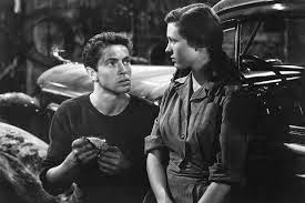
This was an exception, however.  It all began to feel a bit "film noir-ish".  Maybe it was the movie we watched last night:  "They Live by Night" which had two young run-aways spending Christmas on the lam in a tiny motel room, creating a bit of family they never had in the few days they had left together.  They spent money he'd robbed from a bank on tinsel for the tree (his first) and lights for the mantel.  They were "playing house", making it up as they went along.

UPDATE:  My friend Heidi Dean,  Newport Hills Community Club president, passed along the word that her old schoolmate has written posts for "Sisters on the Fly".  On their website, you can find 55 pages of photos of their caravan trailers.  It's a group dedicated to empowering women through the spirit of adventure and pride in your trailer.  Cowgirl spirit.  It's much more than that, too:  they spent this spring demonstrating "Microdwelling" at the Shemer Art Center in Phoenix:

"'Micro' spaces have become a trend in recent years, especially in urban areas where space is limited and the costs of living are high.  In its second year, MicroDwell 2014 is an exhibition of owner built and human inhabited micro-dwellings that highlight the environmental benefits of conscientious material selection, use of salvage materials, and minimization of waste.  Varying from practical to artistic, structures on exhibit are required to be 600 square feet or less, self-contained, modular and portable.
While the idea of less is more may seem like a new concept, 'microdwelling' has deep roots.  Indeed, 1950s families lived in 983 square feet and vacationed in 200 square-foot trailers.  These spaces were more than enough then and Sisters on the Fly have long appreciated this concept, creating warm and welcoming spaces with a lot of imagination (and a little patience.)  Since the group's inception in 1999, the members have been finding, restoring, and traveling in uniquely decorated, one-of-a-kind vintage trailers with whimsical names such as Sister Sioux, Rhinestone Cowgirl, and Calamity Jane.  While these trailers are not a requirement of traveling with the group, they are the ideal for gathering at the end of a long day of fishing for good conversation and great food." 


It was time to leave this brave new world and eat egg salad sandwiches.  Sitting on the banks of the Cle Elum River, we watched a Western Tanager swoop from a treetop to the river over and over and mused on humans and their nesting behaviors.